Subject: Asia
Period: 1562 (circa)
Publication: Cosmographia
Color: Hand Color
Size:
13.5 x 10 inches
34.3 x 25.4 cm
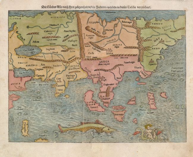
This is one of the earliest maps of the whole continent based on the geographical discoveries by Portuguese navigators. The outline of the Asian mainland is relatively well established, but Munster omits the extreme northeast of Asia, still believed to be joined to the New World. Japan is also missing, as it appeared on Munster's New World map instead. India appears as a peninsula and Sri Lanka, called Zalon, is correctly located. Cambay, Goa and Cannonore are all shown, reflecting the Portuguese presence on India's west coast. Malacca is properly placed on the Malay Peninsula and the Indonesian island of Sumatra has inherited the name Taprobana from Sri Lanka, but also bears the name Sumatra. Java appears as two islands, Java Maior and Java Minor, one shown north of the other. The famed Spice Islands of the Moluccas are located, but oddly shaped. An archipelago of 7448 islands lies off the eastern coastline of China. The Indian Ocean is filled with a huge sea monster and a fantastic two-tailed mermaid.
References: Yeo #2; Walter #8A.
Condition: A
Some minor soil and repaired worm tracks in blank margins, not affecting map.