Subject: Spain & Portugal
Period: 1700 (circa)
Publication:
Color: Hand Color
Size:
22.3 x 19 inches
56.6 x 48.3 cm
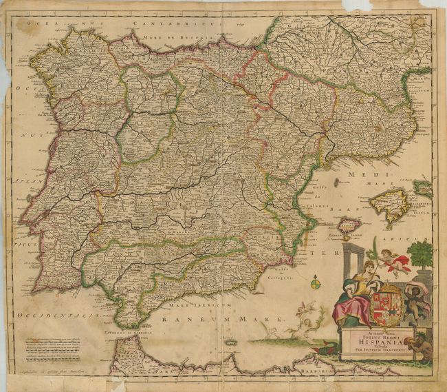
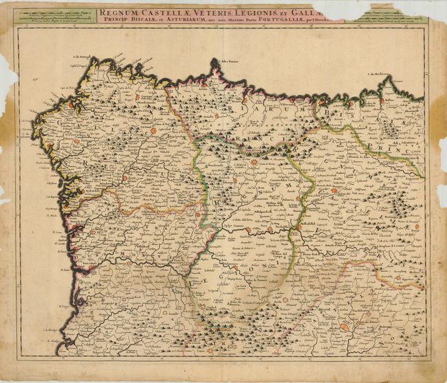
An attractive pair of maps of Spain. Size varies slightly.
1) Accuratissima Totius Regni Hispaniae Tabula is an attractive map of the Iberian Peninsula covered with great detail, and extending to include the Balearic Islands. The elaborate cartouche is centered on the royal crest, flanked by putti and a queen. Original color on a sheet with some worming and loss in the map, border, with some small verdigris cracks and creases. Old paper repairs on verso and in lower margin.
2) Regnum Castellae Veteris Legionis, et Gallae shows the regions of Castile and Galicia in crisply engraved detail, centered roughly on Valladolid. Original color on a sheet with some toning. The map has paper loss of a portion of the title and border at top and at sides with loss of border at the left.
References:
Condition: D
See description.