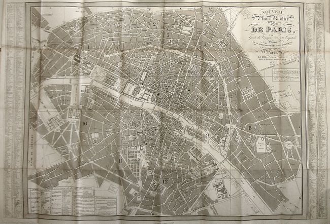
Subject: Paris, France
Period: 1832 (dated)
Publication:
Color: Black & White
Size:
32 x 21.5 inches
81.3 x 54.6 cm
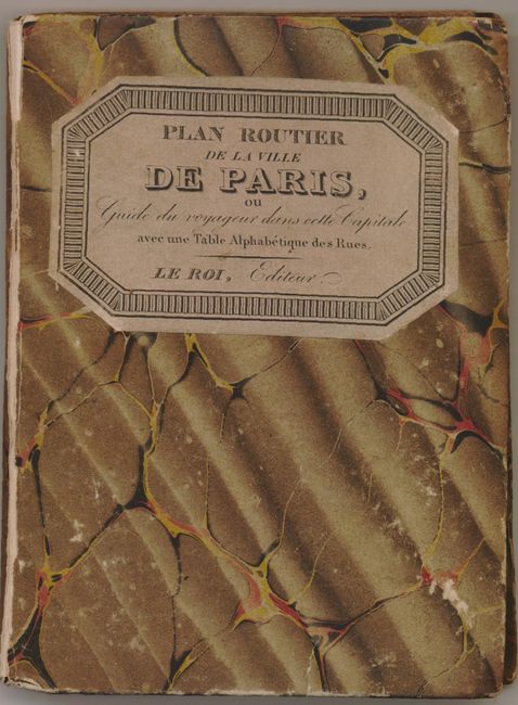
This large pocket map of Paris shows the city center, extending west to Champ de Paris, east to Place du Trone, south to below Val de Grace and up to the Parc de Mouceaux. This depicts the old city before the large changes wrought by Baron Haussmann in the 1860s. It is a graphically handsome plan with fully engraved plots and heavily ruled borders. Tables at sides name and locate more than 1,000 places of interest! At lower left, Division de la ville de Paris places all the wards. The map folds into original boards with marbled paper. Original paper label with title and fancy border is attached. Imprint: le Roi, Libraire Editeur, Place St. Germain l'Auxerrois, No. 24." An uncommon issue in very nice condition.
References:
Condition: A
Cover is very good with just a little rubbing and abrasion to some edges. Marbled paper is split at spine. The map is on very thick paper, folding. The fold intersections have some small splits.