Subject: England
Period: 1675 (circa)
Publication: Britannia
Color: Hand Color
Size:
17.5 x 13 inches
44.5 x 33 cm
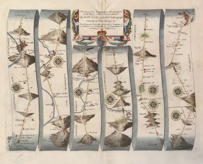
John Ogilby's 'Britannia' was published between 1675 and 1698. It is a landmark in the mapping of England and Wales. Its unique format constituted the first national road-atlas of any country in Western Europe. It was composed of maps of seventy-three major roads and cross-roads, presented in a continuous strip-form, on a uniform scale of one inch to a mile. Each beautiful map includes wonderful detail of the countryside with each strip containing a large compass rose to indicate changes in direction.
A lovely road map that details the route between Tynemouth on the North Sea and west across England to Carlisle with good detail of Newcastle. The picturesque detail includes villages, bridges, river crossings, hills and much more. Decorated with numerous compass roses and a boldly engraved strapwork title cartouche featuring the royal coat of arms.
References:
Condition: B+
A good impression on a sheet with a couple small spots, and a repair on the centerfold.