Subject: England
Period: 1675 (circa)
Publication: Britannia
Color: Hand Color
Size:
18 x 13 inches
45.7 x 33 cm
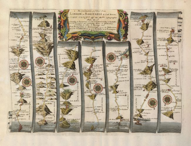
John Ogilby's 'Britannia' was published between 1675 and 1698. It is a landmark in the mapping of England and Wales. Its unique format constituted the first national road-atlas of any country in Western Europe. It was composed of maps of seventy-three major roads and cross-roads, presented in a continuous strip-form, on a uniform scale of one inch to a mile. Each beautiful map includes wonderful detail of the countryside with each strip containing a large compass rose to indicate changes in direction.
Handsome road map in the pictorial style developed by Ogilby. The map begins near Bridgewater and proceeds in a easterly direction to Hatherley, crossing from Somerset into Devon. Each portion of the map is oriented by a compass rose and the cartouche is liberally surrounded with garland.
References:
Condition: A+
Exceptional impression on a good sheet of laid paper with wide original margins. Lower margins with some faint stains, not affecting the map.