Subject: Atlantic Ocean
Period: 1658 (circa)
Publication: Zee-Atlas, ofte Water-Wereldt
Color: Hand Color
Size:
25 x 21.5 inches
63.5 x 54.6 cm
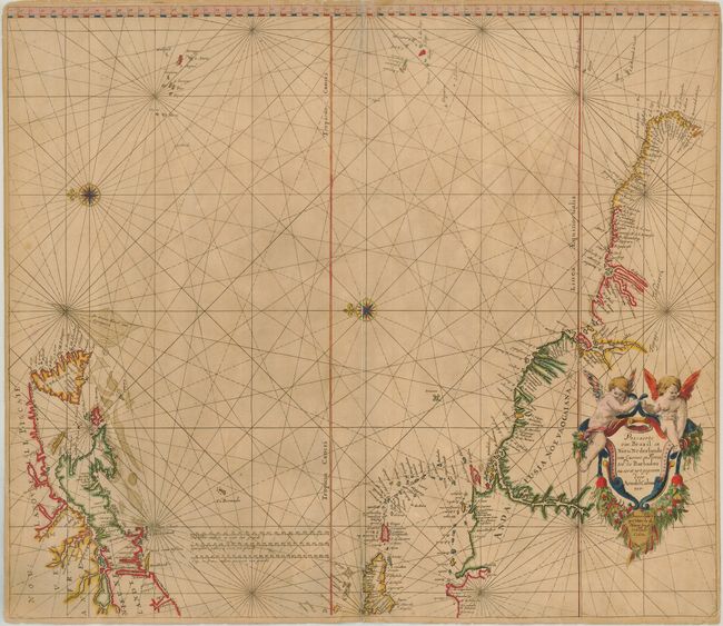
This uncommon sea chart shows the area from Newfoundland to the northern coast of South America and across to the Azores and the Cape Verde islands in an unusual configuration derived from the Theunisz Jacobs chart of 1650, with north oriented to the left. Long Island is named Sandboeck, and New England is named Nieu Nederlant, with no mention of the English colonial presence. The decorative cartouche is festooned with garlands of fruit with two putti perched atop. This is probably the third state; the lower right corner with the pagination has been replaced. Colom's Zee-Atlas is one of the largest format sea-atlases published in Amsterdam during that period, and also one of the scarcest. This plate was later sold to Hendrick Doncker.
References: Burden #321.
Condition: B
A sheet of double-thick paper typical for sea charts of the period. The centerfold is split in several areas and has been repaired with tissue on the verso. The lower right corner has been replaced with two lines of facsimile for the neatline. Still an attractive map with a good impression that presents well.