Subject: Greater Antilles
Period: 1775 (dated)
Publication: The West-India Atlas
Color: Hand Color
Size:
24.8 x 19 inches
63 x 48.3 cm
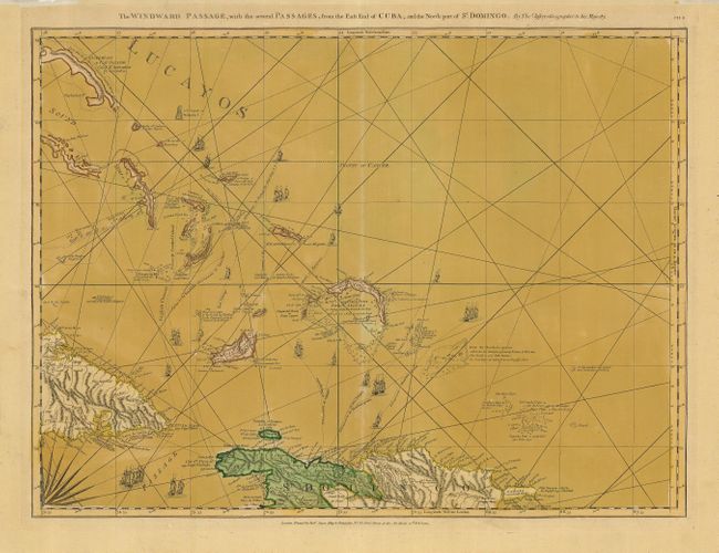
This superb nautical chart covers the shipping channel between Cuba and Hispaniola and the Turks and Caicos Islands north of the passage. Several ships' tracks are shown along with great detail of anchorages, shoals, soundings, etc. Beautifully engraved, the sheet is decorated with rhumb lines, a splendid compass rose and tiny ships. This is the first state with Robert Sayer's imprint at bottom. It is one sheet of the sixteen-sheet map of the West Indies that formed the heart of this important Revolutionary War period atlas. Sheet number CH.8 printed at upper right.
References: Phillips (A) #2699; Sellers and Van Ee #1735.
Condition: B
Good impression. The old color has toned the paper unevenly, but has not affected the integrity or suppleness of the sheet. Hinge remnants at the top margin.