Subject: Washington
Period: 1857 (dated)
Publication: Senate Doc. No. 11 & HR Doc. No. 2, 1st Session, 35th Congress
Color: Black & White
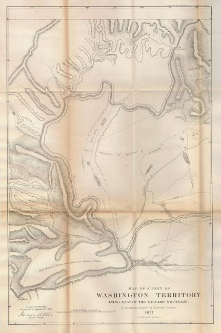
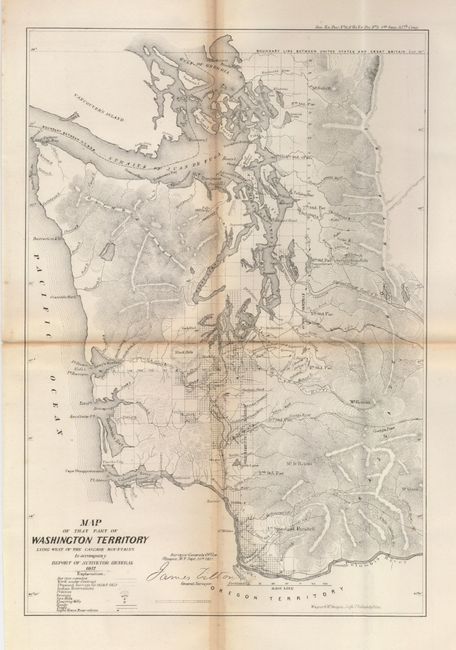
A matched pair of early Washington Territory maps, both signed in the plate by James Tilton, Surveyor General, from the office in Olympia, W.T.
The first details the part of Washington from the Columbia River and Ft. Dallas eastward to Ft. Walla-Walla and north to Ft. Colville. Also shown are rivers, lakes, roads, the Old Presbyterian Mission, and the Pacific Railroad. The map was surveyed by Tilton and lithographed by C.B. Graham, Washington D.C., 1857. (22 x 13.8").
The second is a very detailed map of the western third of Washington, showing early development and cities along the Columbia River and Puget Sound. Olympia, Vancouver, Seattle, and the forts of Steilacoom and Nisqually are located. Also noted are Indian reservations, prairies, swamps, saw mills, flouring mills, roads, trails and lighthouses. Surveyed by James Tilton and lithographed by Wagner & McGuigan, Philadelphia, 1857. (9.2 x 13.4").
References:
Condition: B
Folding, as issued, with toning along most folds.