Subject: New York
Period: 1778 (dated)
Publication:
Color: Hand Color
Size:
22.3 x 14 inches
56.6 x 35.6 cm
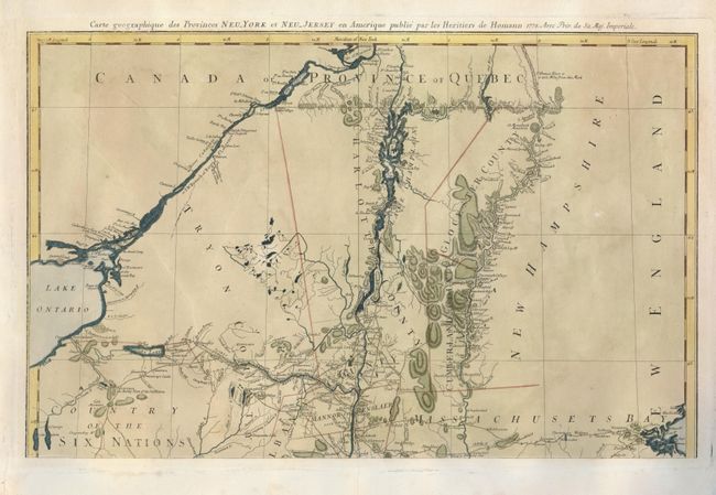
This is the top sheet of the Homann Heir's Revolutionary War period map [Mappa Geographica Provinciae novae Eboraci ab Anglis New-York …Nova Jersey…]. It is based on the survey of the region by Claude Sauthier compiled between 1771 and 1774. The map provides excellent information including topographical detail, towns, forts, churches, roads, ferries, mills, and taverns. This map shows the portion of the map from Boston Harbor in the bottom of the map to Montreal in the top, and includes the Connecticut River, Lake Champlain, the Country of the Six Nations and a portion of Lake Ontario.
References: McCorkle #778.19; Sellers & Van Ee #1049. (Both reference whole map).
Condition: B+
A dark impression with attractive color on a sheet with a few minor spots and creases. The centerfold has been reinforced on the verso and the margins have been repaired, all done professionally.