Subject: Minnesota, St. Paul
Period: 1869 (dated)
Publication:
Color: Hand Color
Size:
20.3 x 16.5 inches
51.6 x 41.9 cm
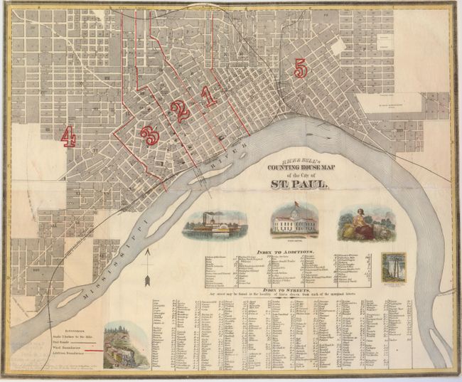
As noted in Phillips, this is the earliest map of the new city and capital of St. Paul, and it was published in that city as well. St. Paul was incorporated in 1854 and its Chamber of Commerce was created in 1867. This detailed depiction shows all the wards, railroads and streets, with a lettered guide below the map. There are a number of vignettes including a steam boat, the State Capitol, a female allegory of the agricultural riches of the area, a railroad engine, and Minnehaha Falls.
References: Phillips (M) pp. 769
Condition: B
This was issued folding, it is now flattened, and some fold separations have been repaired with tissue on the verso. The paper is an onionskin of the type used for folding maps of this period. The margins are trimmed to the neatlines, as issued.