Subject: Boston, Massachusetts
Period: 1860 (circa)
Publication: The Illustrated Atlas and Modern History of the World
Color: Black & White
Size:
12.7 x 10.3 inches
32.3 x 26.2 cm
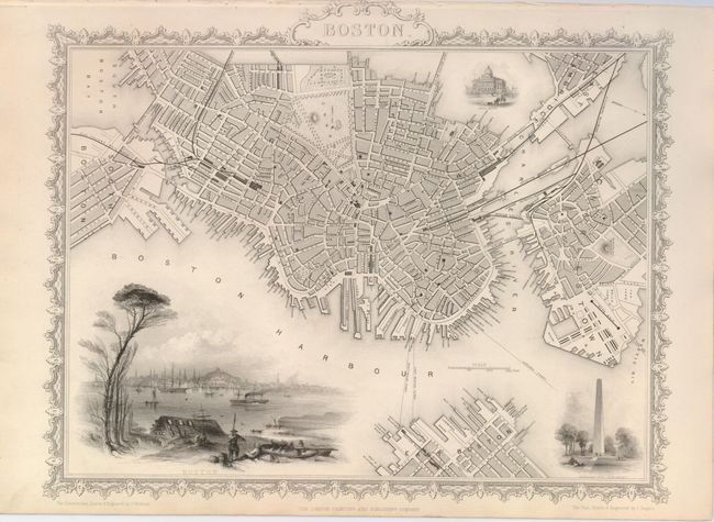
The maps from The Illustrated Atlas were first published in serial form to a target audience that led insular lives due to the expense and hardship of travel. All that changed as the progress of the nineteenth century brought swift and dramatic changes in public awareness of far away places. Tallis' maps no doubt played an important role in this dramatic awakening. These maps not only provided up-to-date geographical knowledge, but also used vignette views within the map's design to show the native people and their occupations, cities and points of interest. The maps hark back to a cartographic tradition from the Dutch mapmakers of the seventeenth century with finely engraved decorative borders. The maps were drawn and engraved by John Rapkin with views drawn and engraved by a number of prominent artists. The maps were issued as a complete volume from 1851 until about 1865. Some of the maps were also published in other history books published by Tallis including British Colonies and, without the vignettes, in geographical dictionaries and encyclopedias until about 1880.
This finely engraved map features a large vignette view of Boston viewed from across the harbor and two smaller ones of Bunker's Hill Monument and the State House. There is detail of all streets, railroads, parks, including Boston Commons, and numerous ferry routes. The area includes portions of East Boston, Charlestown, South Boston and East Cambridge, showing the region as it was before filling in Back Bay in the latter part of the 19th century.
References:
Condition: A
A nice impression with title touching the binding side at top as issued.