Subject: Hawaii
Period: 1904 (dated)
Publication:
Color: Printed Color
Size:
33 x 22 inches
83.8 x 55.9 cm
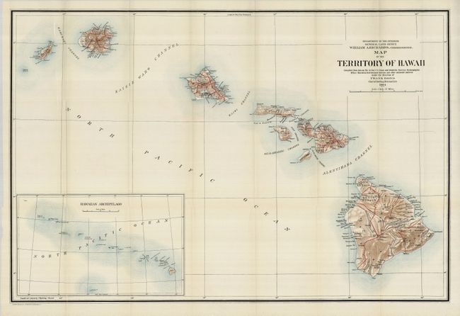
A large, colorful map of the Hawaiian Islands developed shortly after annexation and with little settlement shown outside of Oahu. The Mauna Loa volcano is shown with its lava flows. The chart was "compiled from data on file in the U.S. Coast and Geodetic Survey: Hydrographic Office: Hawaiian Government Surveys, and other authentic sources under the direction of Frank Bond Chief of Drafting Division." Published under the direction of the commissioner William A. Richards. Large inset (12.5 x 7.5"), compiled by I.P. Berthrong, gives a wider view of the entire archipelago, extending beyond Midway Island. Good detail on a scale of 1 inch = 12 miles. Beautiful example of this fine chart.
References:
Condition: A+
Folding, as issued. A mint example with bright color, strong impression, clear paper and wide margins.