Subject: Hawaii
Period: 1902 (dated)
Publication:
Color: Printed Color
Size:
33 x 27 inches
83.8 x 68.6 cm
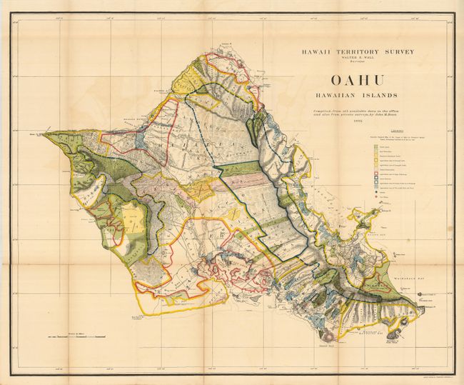
A brilliantly colored and detailed map of Oahu with much information on pineapple and sugar plantations, homesteads, public lands, Crown lands and public buildings. The areas of Diamond Head, Koko Head and Kailua Bay are described, as well as the Cocoa-Nut Grove on Maunaloa Bay, complete with tiny coconut trees. Hawaii's monarchy was overthrown in 1893, and this map was prepared for the Governor's Annual Report of 1906. The governor at this time was George R. Carter. Compiled by John M. Donn "from all available data in the office and also from private surveys."
References:
Condition: B+
Issued folding, now flattened. The usual fold toning and separations that have been repaired on the verso with archival tape. There is a repaired 1.5" tear into the map at left and a few small stains on the right side of the map.