Catalog Archive
Auction 124, Lot 224

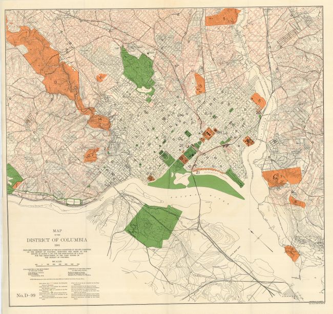
"Map of the District of Columbia 1901… For the Preparation of a Plan for the Improvement of the Park System of the District of Columbia", U.S. Government

Subject: District of Columbia

Period: 1901 (dated)

Publication:

Color: Printed Color

Size:
28 x 26.3 inches
71.1 x 66.8 cm
Download High Resolution Image
(or just click on image to launch the Zoom viewer)

This large and colorful plan depicts current park areas, proposed street development plan, topography and schools. This ambitious map is completely filled with information including the Permanent System of Highways and Authorized New Railroad Locations. Twenty different areas name their controlling agency including the War Department, Navy, Interior Dept., Smithsonian, and more. The map extends to show a corner of Alexandria in the south, and north to include some or all of Kenilworth, Burrville, Woodridge and Takoma, west to American University Park, and east about two miles past the Anocostia River. It is numbered "No. D-99" at lower left, and north is oriented to the upper left. Prepared by J.G. Langdon and printed by A. Hoen & Co. of Baltimore.

References:

Condition: A+

Folding, as issued.

Estimate: $100 - $140

Sold for: $220

Closed on 5/7/2008

Archived