Catalog Archive
Auction 124, Lot 194

"A Diagram of the State of Alabama", General Land Office
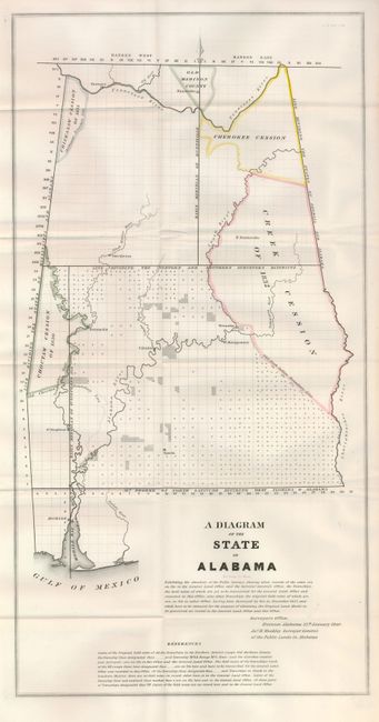
Subject: Alabama

Period: 1840 (dated)

Publication: Senate Doc. 61, 26th , 2nd Session

Color: Hand Color

Size:
11.8 x 22.5 inches
30 x 57.2 cm
Download High Resolution Image
(or just click on image to launch the Zoom viewer)

An early state map that shows surveying progress to 1840. There is no county development, but the settlements of Mobile, Montgomery, Cahaba, St. Stephens, Demopolis, Huntsville, Tuscaloosa, and Sparta are located. Large Indian Cession lands are shown including those of the Creek, Choctaw, Chickasaw and Cherokee. Huntsville is located in the Old Madison County. Signed in the plate, "Surveyor's Office, Florence Alabama 25th. January 1840. Jas. H. Weakley Surveyor General of the Public Lands in Alabama."

References: Claussen & Friis & 371.

Condition: A+

Fine example with original color. Folding, as issued.

Estimate: $120 - $180

Sold for: $170

Closed on 5/7/2008

Archived