Subject: Western United States, Yellowstone National Park
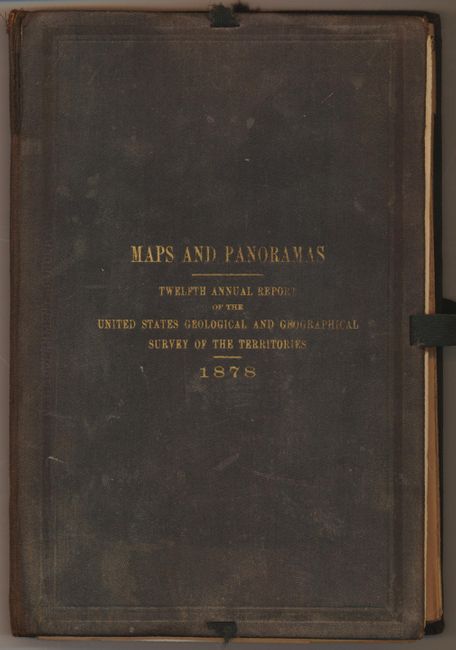
Period: 1878 (dated)
Publication: Survey of the Territories
Color: Printed Color
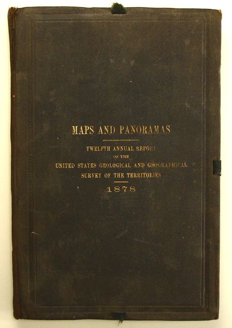
This is a complete set of nine maps and one panoramic view. The inside cover paste-down lists 6 maps and 1 panorama. The 3 additional maps are numbered 8, 9, 10 in the upper right corner, as are the first seven, which suggests the paper label is inaccurate and that all of the maps were intended to be issued in this fashion. The first six maps have brilliant lithographed color. The maps cover the region of Yellowstone, and parts of Wyoming, Idaho and Utah. All folding into original hardbound covers with gilt titling, missing most of the ribbon ties. Most sheets have some of the typical fold separations as described below. A scarce set rarely seen together.
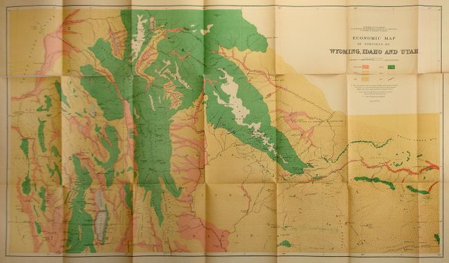
1) Economic Map of Portions of Wyoming, Idaho and Utah, April 1879 . This map has fold splits, particularly in the top third of the map (36 x 20.5").
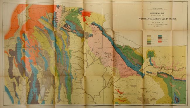
2) Geological Map of Portions of Wyoming, Idaho and Utah. Just a couple of fold splits (36 x 20.5").
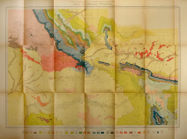
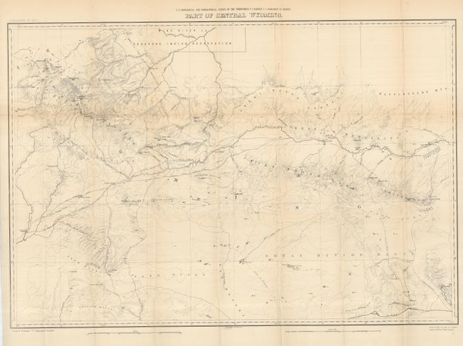
3) Part of Central Wyoming. Couple of fold separations, one tear into the bottom of the map about 3" (33.3 x 22.5")
4) Parts of Western Wyoming and Southeastern Idaho. (32.5 x 22.8").
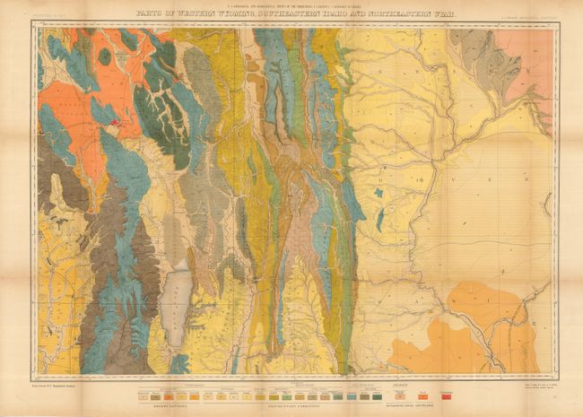
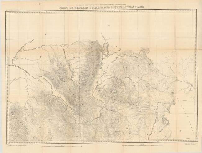
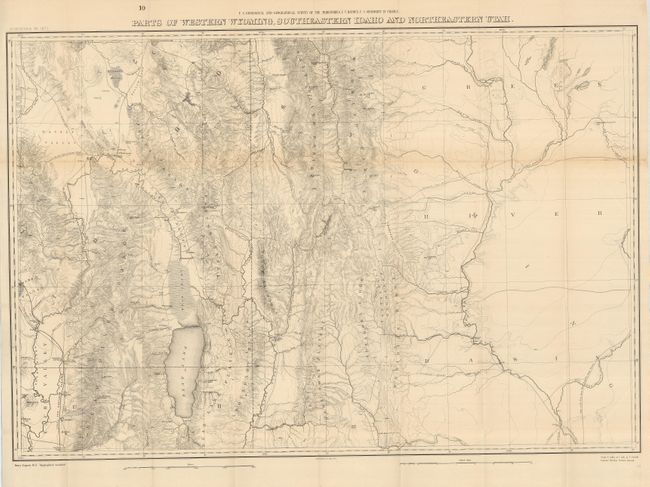
5) Parts of Western Wyoming, Southeastern Idaho and Northeastern Utah. A few minor separations at fold intersections (33 x 22.6") .
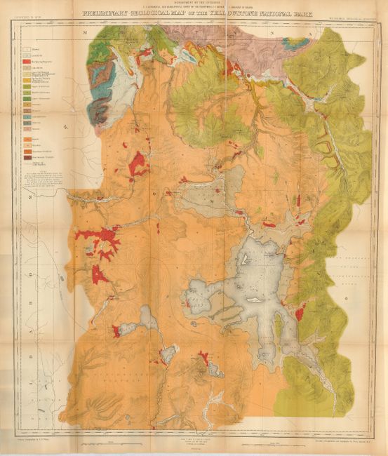
6) Preliminary Geological Map of the Yellowstone National Park. A number of fold splits, tear in map. (28.5 x 32").
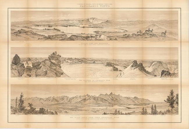
7) Panoramic Views - Glacial Lake and Morains; The Glaciers of Fremont's Peak; The Teton Range from Upper Grosventre Butte [in the Wind River and Teton Mountains]. Very good condition with brown tinted lithographic color (35 x 23.2")/
8) Part of Central Wyoming. Uncolored with very small intersectional fold splits (33.2 x 22.7").
9) Parts of Western Wyoming, and Southeastern Idaho. Uncolored with very small intersectional fold splits (32.7 x 22.5")
10) Parts of Western Wyoming, Southeastern Idaho and Northeastern Utah. Uncolored with very small intersectional fold splits (33 x 22.6").
References:
Condition: B+
See descriptions.