Subject: Central United States
Period: 1855 (dated)
Publication: Atlas of the World
Color: Hand Color
Size:
15.8 x 13 inches
40.1 x 33 cm
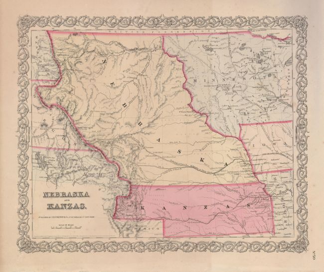
This is the first edition of this important and early map of the transitional territories of Nebraska and Kanzas. In 1854, the United States passed An Act to Organize the Territories of Nebraska and Kansas with this configuration. That act also repealed the Missouri Compromise, allowing slavery in the territories north of the 36° 30´N latitude, provoking violence in the region between pro-slavery and anti-slavery settlers. Nebraska is shown as a massive territory incorporating part of the present-day Dakotas, Wyoming and part of Colorado, with its northern border with Canada. Kansas reaches west to include part of present-day Colorado. Minnesota Territory is shown at its largest extent, with its western border on the Missouri River. The map is surrounded in Colton's trademark strapwork border and the verso is blank.
References: Blevins, Mapping Wyoming #96.
Condition: B+
A little faint irregular toning, still a nice example with original hand coloring.