Subject: Colonial Central and Southern United States
Period: 1760 (published)
Publication: British Magazine
Color: Black & White
Size:
8.5 x 7.2 inches
21.6 x 18.3 cm
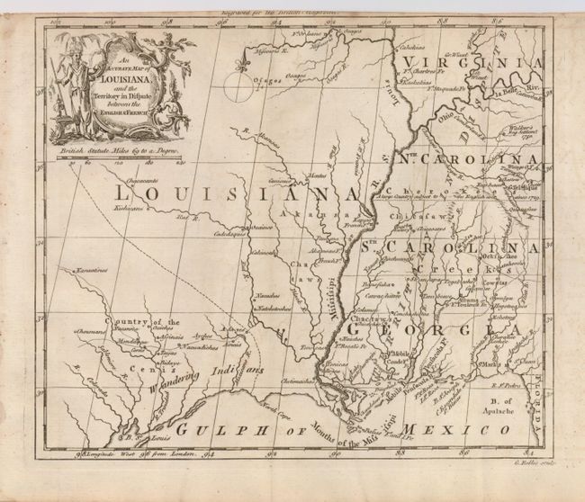
An unusual map of the Mississippi River valley and the Gulf Coast made towards the end of the French and Indian War. It shows the colonial holdings in the southern portion of the continent that were disputed and finally resolved by the Treaty of Paris in 1763. The British colonies of North and South Carolina, Virginia and Georgia are shown with their western borders on the Mississippi River. A note across them states they are a Territory in Dispute. The region west of the Mississippi is labeled Louisiana with several Indian nations located. Present-day Texas is labeled Country of the Cenis and Wandering Indians. Only one other example of this map was offered for sale in 20 years of price records.
References: Jolly, BRITB-2.
Condition: B+
A good impression on a sound sheet, issued folding with a binding trim at top near the neatline. Some very faint offsetting, else very good.