Subject: United States
Period: 1833-1920 (dated)
Publication:
Color:
A nice set of folding maps that show the evolution of Indian Reservations in the United States over a period of 97 years.
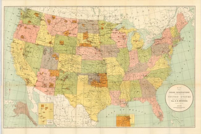
1) Map Showing Indian Reservations within the Limits of the United States Compiled under the Direction of Hon. D.M. Browning. Commissioner of Indian Affairs. 1896, printed color (33 x 21.3"). This colorful map shows reservations across the United States and locates towns, railroads, military stations, schools, and Indian agencies. There are insets of Indian Territory, Mission Ind. Res. of California, and Alaska. Lithography by Norris Peters Co., Washington D.C.
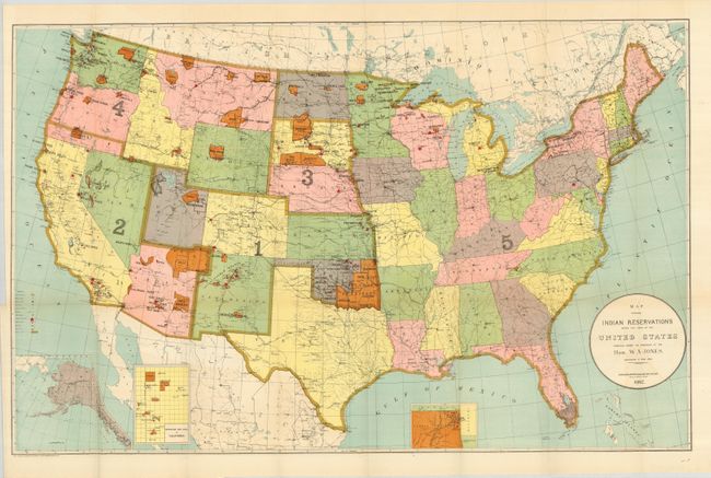
2) Map Showing Indian Reservations within the Limits of the United States Compiled under the Direction of Hon. W. A. Jones. Commissioner of Indian Affairs. 1902, printed color (33 x 21"). Shows reservations across the United States and locates towns, railroads, military stations, schools, asylums and Indian agencies. This map also has insets of Oklahoma, Mission Ind. Res. of California, and Alaska. Lithography by Norris Peters Co. Washington D.C.
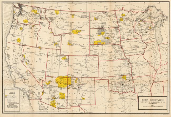
3) Indian Reservations West of the Mississippi River 1920, printed color (39 x 26.3"). Very detailed representation of current and former reservations, schools, hospitals and railroads.
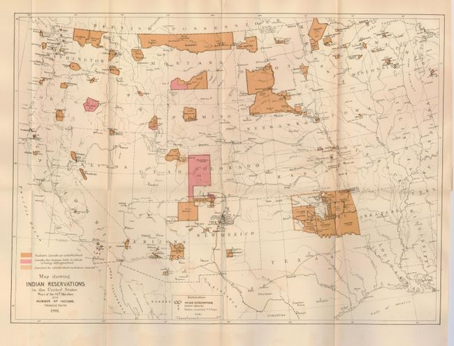
4) Map Showing Indian Reservations in the United States West of the 84th Meridian and Number of Indians belonging Thereto 1881, printed color (18" x 13"). A finely engraved example that shows existing, proposed and "extinguished" Indian lands in unique colors. This map also shows Indian agencies, Army outposts, towns, railroads and Yellowstone National Park.
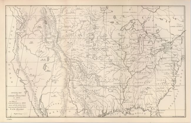
5) Outline Map of the Indian Localities in 1833. George Catlin, uncolored (13 x 8"). This great map was published in an edition of Catlin's Indian Gallery. The map names scores of Indian Villages, all located by tipi symbols. The map extends well into Canada, locating numerous Canadian tribes. There is good detail of watershed and the known mountain ranges. The West is mostly blank and contains erroneous information in the Great Basin region derived from Fremont's map, including an east-west flowing river. Texas is shown with its northern border extending well into the Rocky Mountains, but it is indistinct at its upper reaches. Of special interest is the depiction of the Buffalo Range that stretches throughout the entire plains region.
References:
Condition: A+
All folding, as issued. Map #4 has some minor offsetting in the blank margins.