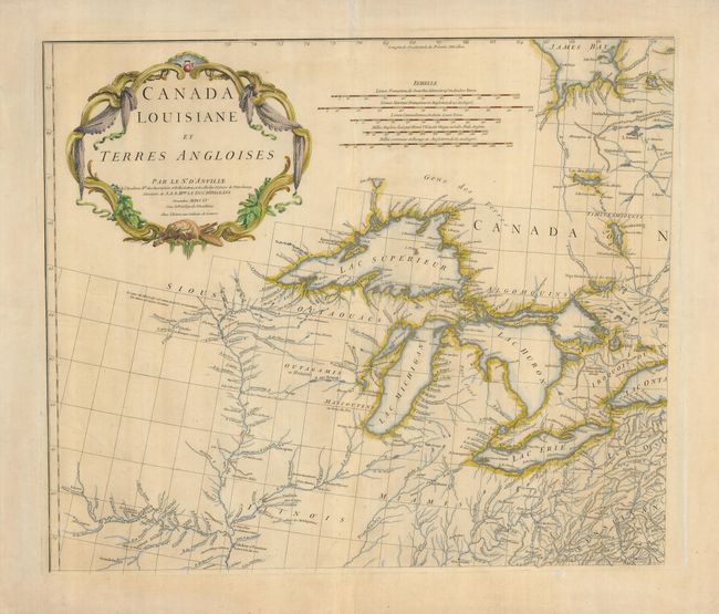
Subject: Colonial Great Lakes
Period: 1755 (dated)
Publication:
Color: Hand Color
Size:
21.8 x 18.7 inches
55.4 x 47.5 cm
This large-scale map is the northwest portion of a four sheet map featuring the Great Lakes and upper Mississippi River. This map extends to the southern end of James Bay, and shows all of Lakes Superior, Michigan, and Huron, with a portion of Lake Ontario. The Keweenaw peninsula is named as Kiaonan, and Isle Royale is called I. Minong. The map was based in part on Mitchell's famous map of the United States. D'Anville's usual, superb cartographic detail is seen throughout. A handsome cartouche designed by Gravelot fills the upper left of the map.
References: Cumming (SE) #296;Tooley (Amer) p.316.
Condition: B
A good impression with delicate color. The verso is reinforced with tissue and there are a few light creases in the map. The lower margin has a separation, not affecting the map.