Subject: Western Canada
Period: 1908 (dated)
Publication:
Color: Printed Color
Size:
33 x 39.5 inches
83.8 x 100.3 cm
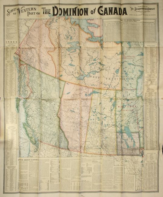
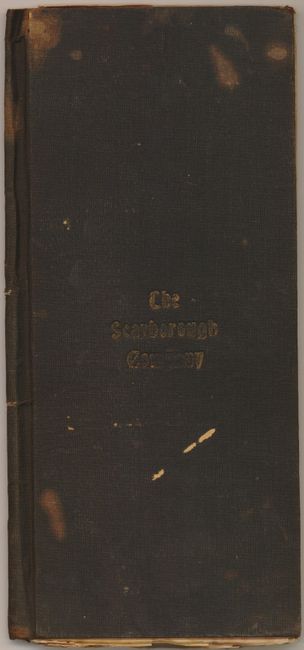
This colorful map includes the provinces of British Columbia, Yukon, Alberta, Saskatchewan, North West Territories, and Manitoba. Red over-printing above Manitoba shows the "Proposed Manitoba Extension" with the unorganized region further north labeled "Keewantin." This uncommon map includes numerous table of information including town index, table of distances, list of lakes, rivers, and populations. Surrounded by keyboard-style border and embellished with Victorian-style titling. The large pocket map folds into original, brown cloth covers with gilt-stamped "The Scarborough Company" on front. Published in Hamilton, Ontario.
References:
Condition: B
The map is bright and very lovely less a tear where attached to back cover and a few fold intersection splits. Covers are worn with some looseness at spine and a few light stain spots.