Subject: Canada
Period: 1778 (circa)
Publication: Atlante Novissimo
Color: Hand Color
Size:
16.5 x 12 inches
41.9 x 30.5 cm
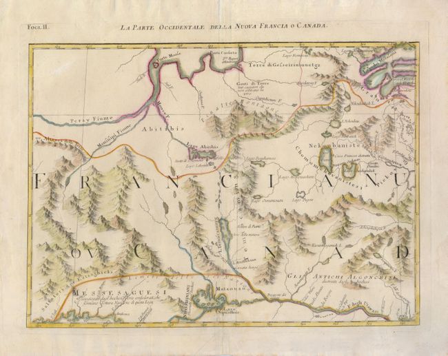
This is an important map of the region between James Bay, Lake Mistassini (Lac Mistassine), Lake Huron and Montreal (named in the lower right as Monreal. The map is actually one of twelve sections comprising the Italian version of Mitchell's landmark map of North America. This Italian edition is richly illustrated with annotations not found on the English version. It includes remarkable detail regarding towns, roads, rivers and mountains. The boundary of the Six Nations is prominently shown.
References: Kershaw #981; Portinaro & Knirsch #145.
Condition: B+
The map has a few minor creases and a small abraded spot in an unengraved area in the upper left portion of the map. There is a faint damp stain at bottom.