Subject: World
Period: 1780 (circa)
Publication: La Harpe's Abrege de l'Histoire Generale des Voyages
Color: Black & White
Size:
27.3 x 19.7 inches
69.3 x 50 cm
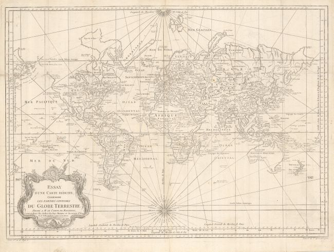
This is a very large world chart presented on Mercator's projection, that originated in 1748 and went through several revisions until the turn of the century. North America is shown with a Fl. de l' Ouest connecting through a series of rivers and lakes from Lake Superior to the Pacific - representing the elusive Northwest Passage. The Russian discoveries in the North Pacific show Alaska as an island named I. Unamak. Australia is labeled Nouvelle Hollande with Terre de Diemen linked to the mainland. New Zealand is fully formed and there are numerous islands in the Pacific. Large, decorative title cartouche and two fine compass roses projecting rhumb lines make this a very attractive chart. There is a note on the map dated 1774, and the geography depicts the discoveries from Cook's first voyage to Tahiti, New Zealand and Australia from 1769-71. The map was published circa 1780.
References:
Condition: B+
A sturdy sheet, issued folding and now flattened. The map has a couple of small rust spots and some faint offsetting.