Subject: Arizona
Period: 1905-13 (dated)
Publication:
Color: Printed Color
Two Arizona maps, before and after statehood, making for an interesting comparison.
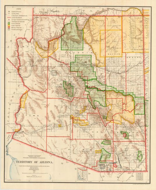
1) General Land Office, 1905. Colorful and fascinating map that provides a detailed look at the territory just seven years before statehood. The extent of nine Indian reservations and three Military reservations, including Fort Apache, and numerous National Forest Reserves are clearly shown in different colors. Private claims, confirmed and unconfirmed, are outlined in red. The Grand Canyon Forest Reserve is shown. Brown hachured mountainous areas and blue waterways combine to provide great visual impact. Details include watershed, mountains, railroads, wagon roads, private claims, unsurveyed townships, etc. This map initially appears identical to the 1903 edition, but closer study shows subtle but important differences. Drawn by Daniel O'Hare, and lithographed by the Norris Peters Co., Photo-Litho. (17 x 20.3"). Grade A.
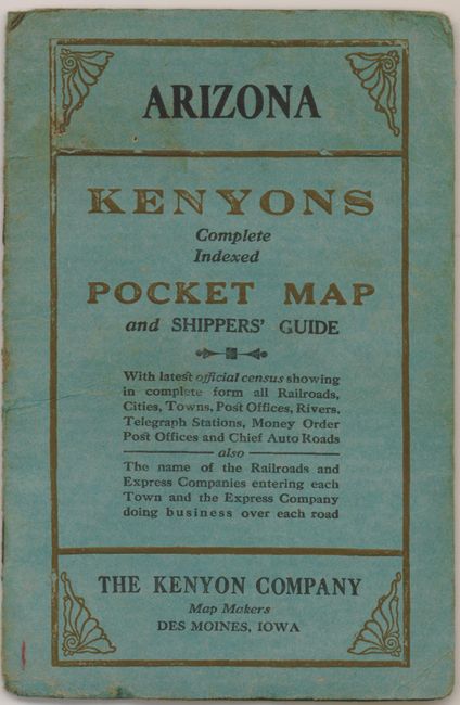
2) Full title on front cover is Arizona - Kenyon's Complete Indexed Pocket Map and Shipper's Guide. Beautifully colored and detailed, this scarce map folds into soft covers and includes 12-pages of city and town index, as well as a postal rate guide. The Kenyon Co., Des Moines, 1913. (20 x 15.5"). Fold separation repaired with archival tape on verso. Grade A.
References:
Condition:
See individual descriptions. Both folding as issued.