Subject: Mexico, Baja California
Period: 1703 (circa)
Publication:
Color: Hand Color
Size:
13.5 x 9 inches
34.3 x 22.9 cm
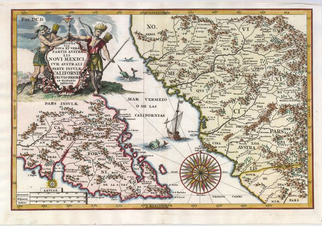
Lovely, decorative map of the tip of Baja California and a portion of northwest Mexico with parts of Sonora and Sinaloa. California is noted as an island, and there is excellent detail of mountains, river systems, woods and towns. This map was redrawn by Scherer after the 1685 manuscript map sent to him from New Spain by his compatriot, Jesuit missionary Father Eusebio Francisco Kino. Kino's explorations of 1684/5 eventually led to his realization that California was not an island, but that conclusion had not yet been reached when this map was created. The map is adorned with a cartouche featuring natives holding a crucifix. The sea teems with monsters and a galleon, and a large compass rose is shown in the Mar Vermeio. Heinrich Scherer, professor of mathematics at Munich was a devout Jesuit whose work emphasizes the Catholic hierarchy and the spread of Jesuit missions throughout the world.
References:
Condition: A+