Catalog Archive
Auction 121, Lot 256

"Delta of the Mississippi. Surveyed at the Suggestion of the Special Board of Engineers… From the Original Survey of A. Talcott, by Th. J. Lee…", Stone, W. J.

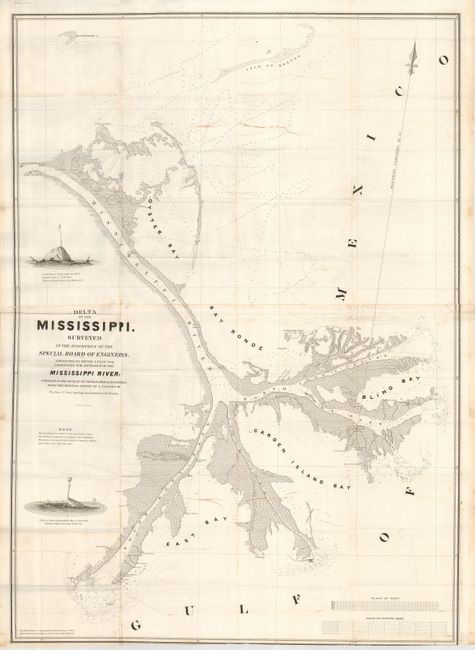
Subject: Mississippi

Period: 1840 (circa)

Publication:

Color: Black & White

Size:
30 x 41.5 inches
76.2 x 105.4 cm
Download High Resolution Image
(or just click on image to launch the Zoom viewer)

This large map was produced as part of a plan to improve the entrance to the Mississippi River. The silt from the river was causing problems with navigation. This is graphically depicted on the map with two engraved vignettes; S.S.W. View of Mud Lump, the Wart, and S. View of Carr's Lump., which are small islands marked with makeshift markers to alert ships to navigational hazards. The chart locates Oyster Bay, Bay Ronde, and Garden Island Bay. Also shows Steere's Reef, the South and North East lighthouses, numerous bayous, and much more.

References: Claussen & Friis #358

Condition: B+

Two areas of marking or foxing and a few fold intersection splits. A good example of this large chart.

Estimate: $150 - $250

Sold for: $110

Closed on 9/26/2007

Archived