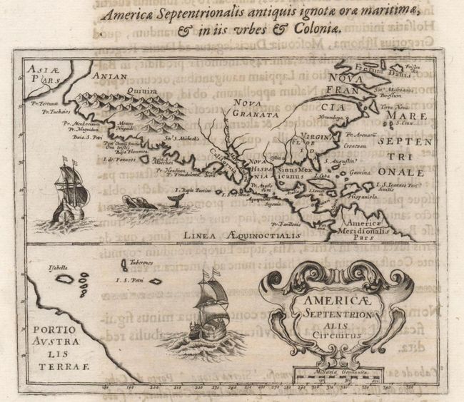
Subject: North America
Period: 1643 (published)
Publication: Orbis Maritimi
Color: Black & White
Size:
6.5 x 5.3 inches
16.5 x 13.5 cm
Rare map of North America based primarily on the work of Hondius. The map shows a peninsular California with many place-names along the coast, translated from Spanish literally to Latin, resulting in such names as P. Fraudulentu for Cabo Engano, and Montes Niuguidi for the Sierra Nevadas. The bulk of the place-names are located on the western coast, with just a few names on the eastern coast, including Norumbega, Pr. Arenaru, and Croatoan. Asiae Pars appears in the North Pacific, and a part of the mythical Australis Terrae is shown in the South Pacific. The portion of the map below the equator is filled with a large cartouche, obscuring South America. A pair of beautifully engraved ships and a sea monster decorate the map. The map is printed on a sheet of Latin text, (8.5 x 13.8") with text on the verso. Claude Barthélemy Morisot ( 1592-1661), was one of the best-known intellectuals of his period. He published the only edition of his extensive naval history, Orbis Maritimi in 1643 .
References: Burden #264; Wagner #348.
Condition: B
Sharp impression on a sturdy sheet with some toning and show through of text on verso. One short tear in lower right margin, well away from both text and map.