Subject: Western Hemisphere
Period: 1758-184 (circa)
Publication:
Color: Hand Color
An interesting group of maps showing the changing cartography of the Americas over nearly one hundred years, including California as an island.
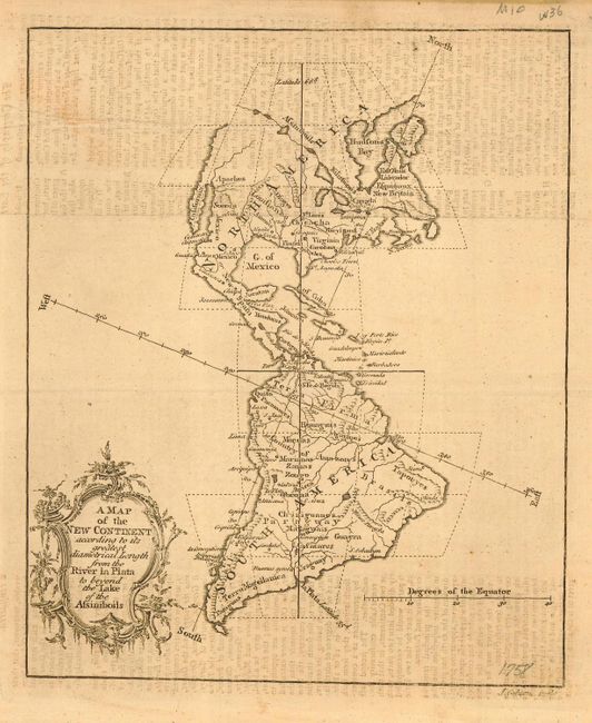
1) A Map of the New Continent according to its greatest diametrical Length from the River la Plata to beyond the Lake of the Assiniboils. Very interesting, somewhat twisted projection with a long Northwest Passage reaching across from the Great Lakes toward the Pacific. Beautifully engraved by John Gibson, published in Gentleman's Magazine in 1758. (7 x 8.3")
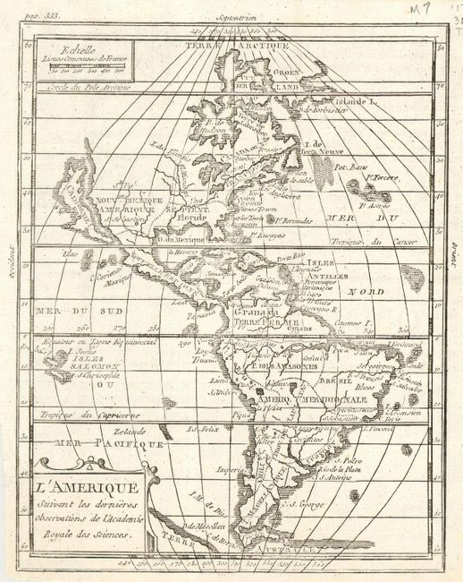
2)L'Amerique Suivant les dernieres observations de l'Academie Royal des Sciences is a small map of the Americas with California as an island. The simple map shows the major political divisions with very few place names. Terre Australe still appears below Tierra del Fuego. Apparently a derivative of Denise Macquart's map, although it does not match exactly with McLaughlin's description. This example has page 333 in upper left and has the complete title Mer du Nord in the Atlantic. Black and white, circa 1760. (5.3 x 6.8")
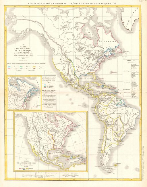
2) Cartes Pour Servir a L'Historie et des Colonies Jusqu'en 1763 shows North and South America with colonies delineated by color. Insets of the colonial possessions in North America in 1667 and 1763. By L. Dussieux, hand colored. (11.5 x 14.5")
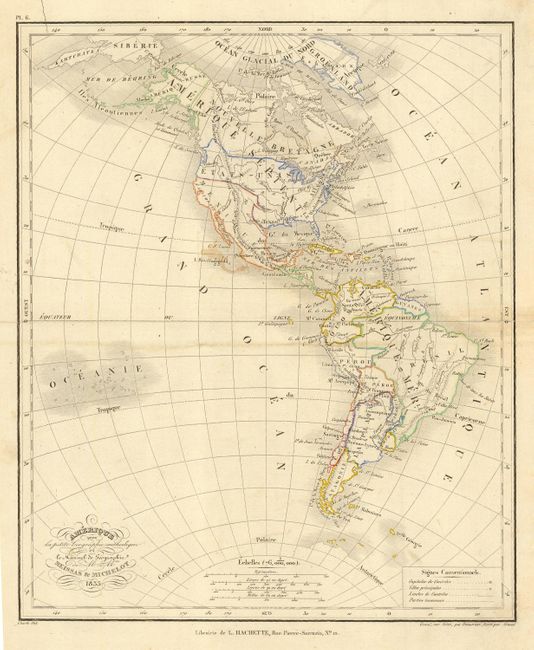
3) Amerique pour la petite Geographic methodique et Manuel de Geographie shows the United States extending into Canada. It was created by Meissas & Michelot in 1835. The countries are delineated with original hand coloring. (8.5 x 10.5")
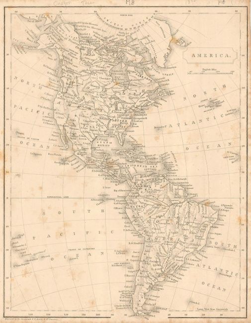
4) America is an interesting, small map with Oregon Territory reaching up into Canada to about 54╓. The map is filled with a number of place names, including Texas, which appears to be independent. Engraved by F. P. Becker, circa 1842 (8 x 10.3")
References: Map 1, cf McLaughlin #73; Map 3, Jolly-GENT #121.
Condition: B
Most maps good. Map 2 with a light stain, Map 4 with some foxing, Map 5 with offsetting.