Subject: Western Hemisphere
Period: 1758 (circa)
Publication:
Color: Hand Color
Size:
23.5 x 18.8 inches
59.7 x 47.8 cm
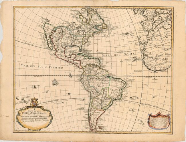
Scarce and unusual Spanish map of the Americas based precisely on Guillaume Delisle's map of 1722. North America is criss-crossed with spurious mountain ranges and rivers in the West. There is a hint of a Northwest Passage via Hudson Bay indicated with a note in Spanish that no one has gone further. The French territory of Luisiana takes up the lion's share of North America at the expense of the British colonies, while Nueva Espana extends from Central America to north of Santa Fe. South America is shown with dramatic river systems, locating a fictitious Laguna Maniora as the headwaters of the La Plata River. The map is decorated with a strapwork cartouche surmounted with the coat-of-arms of Don Fernando, the Prince of the Asturias, to whom the map is dedicated. A block of explanatory text within a drape-style banner balances the map in the opposite corner.
References:
Condition: B
Nice impression and old color on a sturdy sheet. There are a few insignificant spots of foxing in the map. The margins have a few short tears and one manuscript notation on the left.