Subject: Reference Books
Period: 1973-96
Publication:
Color: Black & White
1) "An essential book for those wishing to make a detailed study of early American maps." The "Annotated Check List of Printed and Manuscript Regional and Local Maps of Southeastern North America during the Colonial Period" describes 450 maps. Illustrated with 67 maps. Cumming, William P. Chapel Hill, NC, 1973. (8.8 x 11.2") 8vo. Original hardbound in beige cloth with gilt title on spine. Some light soiling on covers, otherwise like new condition.
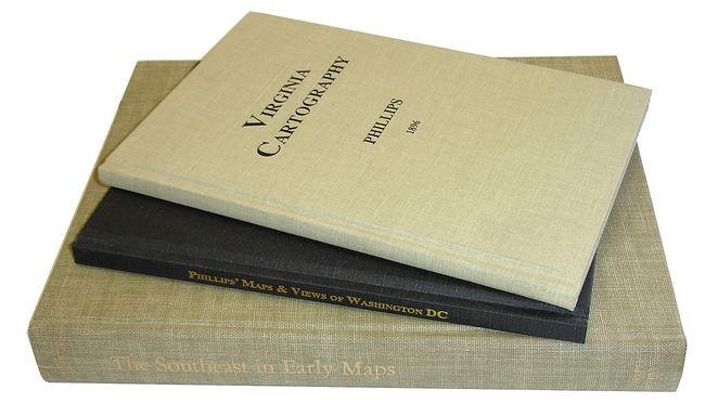
2) A list of 200-plus maps that remain, "…an analytical, interesting view on the mapping of one of the earliest Europeanized parts of our country." Phillips, P. Lee, 1896. Reprinted 1995. (6.3 x 9.3"). 8vo. 85 pages. Original hardbound with beige cloth. Near new condition.
3) This reprint, edited by Francis J. Manasek, was only slightly modified by making grammatical corrections to the text from the original. An excellent reference for Washington, D.C. enthusiasts. Phillips, P. Lee, 1900. Reprinted Norwich, VT, 1996. (6.3 x 9.3") 8vo. Original hardbound in black cloth with gilt title on spine, and no visible wear inside or out.
References:
Condition: A+
All three books are near-mint. A splendid group of important references.