Subject: Western Hemisphere
Period: 1740 (circa)
Publication:
Color: Hand Color
Size:
18.5 x 18.5 inches
47 x 47 cm
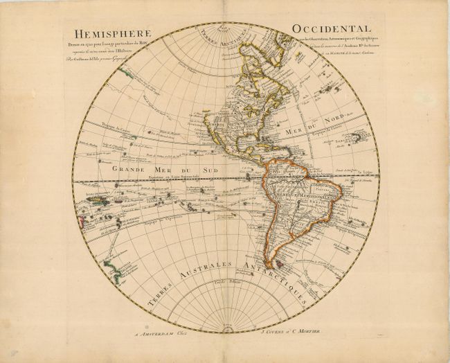
This fine map of the Western Hemisphere provides a nice view of the geographic knowledge in the New World in the early part of the 18th century. The northwest coast of North America is completely blank, reflecting Delisle's scientific approach to cartography. The French territory of Louisiane takes up the lion's share of North America at the expense of the British colonies. This political bias is due to Delisle's position as geographer to the King of France. The map shows the routes of explorers Halley (1700), Tasman (1642), St. Antoine (1710) and many others. The coasts of New Zealand and Australia are just beginning to take shape with a small bit of coast shown for each reflecting the discoveries of Tasman.
References:
Condition: B+
Nice impression with original outline color. A few minor spots of foxing, still a good map on a large, sturdy sheet of paper.