Subject: Atlases
Period: 1862 (circa)
Publication:
Color: Hand Color
Size:
14.8 x 18.5 inches
37.6 x 47 cm
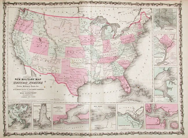
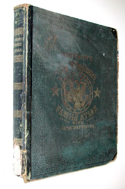
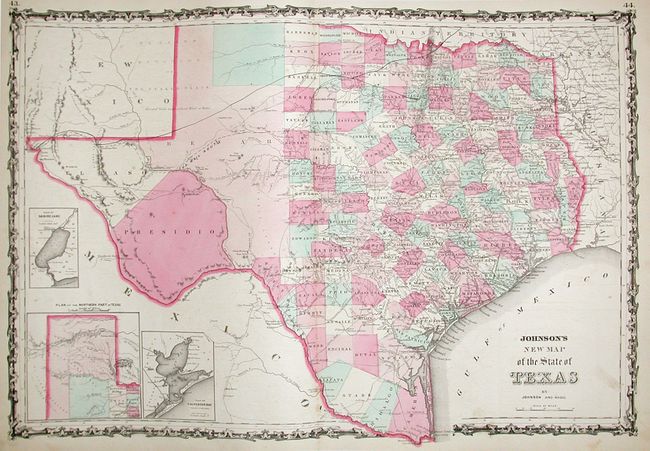
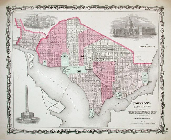
This popular atlas contains forty three single and half page maps, and twenty five double page maps. These are all beautiful, steel engraved plates with rich color and tremendous detail. This is the "late 1862" edition of this desirable atlas, and is highlighted by the short-lived New Military Map of the United States. And California, Territories of New Mexico and Utah where Arrizona shows up in the southern part of New Mexico Territory. This is thought to represent the Confederate Territory of Arizona that existed for nearly a year from August 1861 until July of 1862. The Confederate General Baylor appointed himself the territorial governor and claimed all of New Mexico Territory south of the 34th parallel. In the southern part of Arizona is the "Gadsden Ten Million Purchase of Mexico." The Utah/Nevada border follows the 116th meridian. Filled with historical notes and two interesting notations. One note in the area of Quartzsite, Arizona refers to the area as being "exceedingly fertile and abundantly timbered and well watered." Details the U.S. Mail routes, the Emigrant road to California, the proposed railroad route through Utah, Nevada and California, and the Pony Express trail. Also featured in this atlas are Georgetown and the City of Washington; New Map of the State of Texas and a beautifully engraved frontispiece. This atlas also contains several thematic maps and diagrams interspersed throughout the text. Nearly complete and being offered as a set of maps. Folio. Original hardbound in Green cloth with quarter calf spine and tips with titling in gilt on front cover and spine.
References:
Condition: B
Text and maps generally good, more important maps good to very good. Occasional scattered and variable foxing and soiling. Several maps with fold separations. Spine and boards separated and shelf worn with some loss. Signatures loose and partially unbound. Missing the title page and map of Ancient Greece.