Subject: Atlases, Revolutionary War
Period: 1835 (circa)
Publication:
Color: Hand Color
Size:
5.7 x 9 inches
14.5 x 22.9 cm
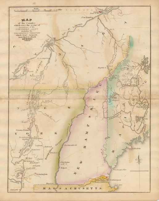
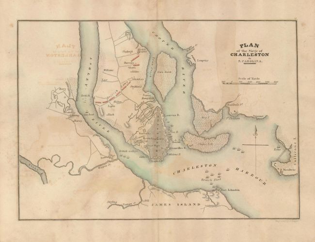
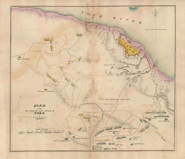
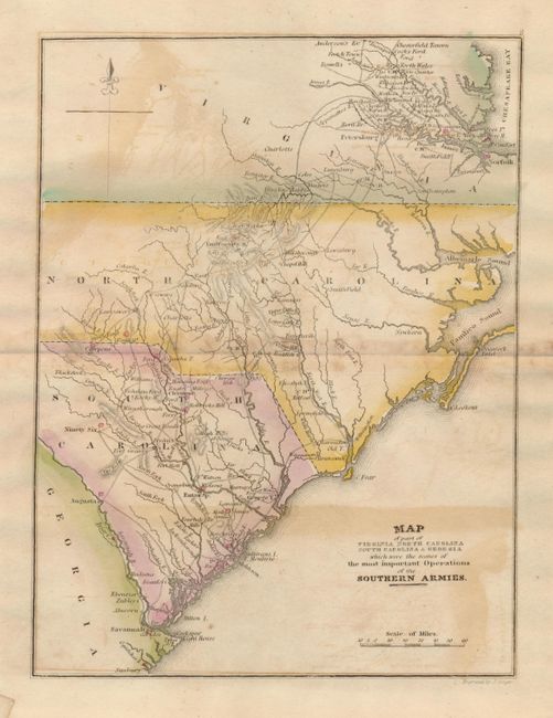
This atlas features nine of ten hand colored maps showing the positions and movements of General Washington, and several other British and American generals, during the American Revolutionary War. The maps measure approximately 9" x 7" and include the following:
1) Plan of the Siege of Charleston in S. Carolina
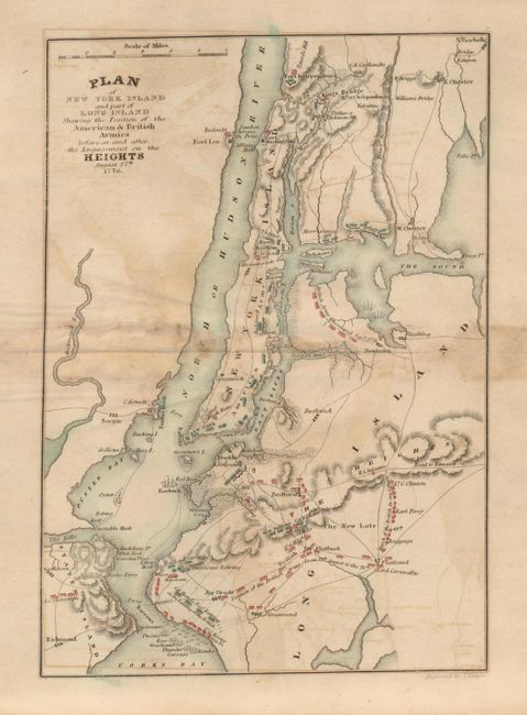
2) Plan of New York Island and part of Long Island Shewing the Position of the American & British Armies before and after the Engagement on the Heights August 27th 1776.
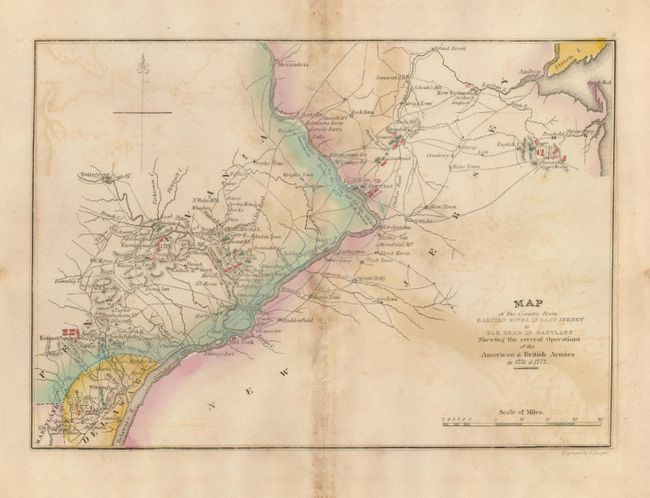
3) Map of the Country from Raritan River in East Jersey to Elk Head in Maryland. Shewing the several Operations of the American & British Armies in 1776 & 1777.
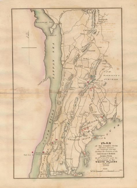
4) Plan of the Country from Frogs Point to Croton River Shewing the Positions of the American & British Armies from the 12th of Oct. 1776 until the Engagement on the White Plains.
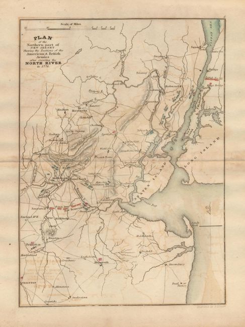
5) Plan of the Northern part of New Jersey Shewing the Positions of the American & British Armies after crossing the North River in 1776.
6) Plan of the Investment and Attack of York in Virginia.
7) Map of the Country which was the scene of Operations of the Northern Army Including the Wilderness Through which Genl. Arnold marched to attack Quebec.
8) Map of part of Virginia Northern Carolina South Carolina & Georgia which were the scenes of the most important Operations of the Southern Armies.
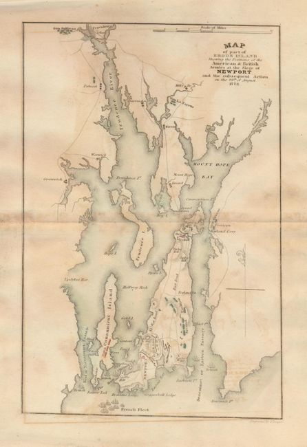
9) Map of part of Rhode Island Shewing the Positions of the American & British Armies at the Siege of Newport and the subsequent Action on the 29th of August 1778.
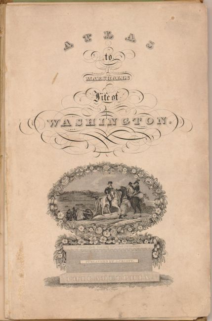
The tile page features very decorative titling and a nice engraved vignette of Gen. Washington crossing the Delaware River. This lot is a set of maps and is sold as is, not subject to return as each of the remaining maps is loose. The Boston and its Environs map is absent. Crude cover with all maps loose. Published by J. Crissy, 8vo.
References:
Condition: B
The maps have a little scattered foxing or toning and some offsetting. Covers were rebound with cloth spine and tips, now disbound entirely. Still a nice set of maps that will appeal to many collectors of Americana.