Subject: Western Hemisphere
Period: 1671 (circa)
Publication: De Nieuwe en onbekende weereld…
Color: Hand Color
Size:
21.4 x 17.2 inches
54.4 x 43.7 cm
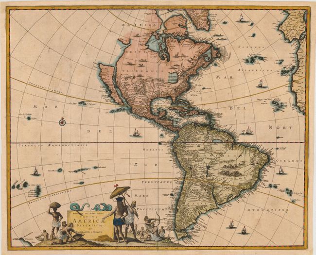
This uncommon map of the Americas is based largely on Visscher's map of 1658. California is shown as a large island with a flat northern coastline. The mainland coastline continues northeast toward the Straet Anian, which separates it from Anian. In the Southwest, the Rio del Norto flows from a large interior lake, and empties into the sea between the mainland and California. One of its most recognizable features is the huge open-ended lake in the vicinity of the Great Lakes. In South America, Parime Lacus is prominent. The map is decorated with numerous vignettes of wildlife and sailing ships and the large title cartouche features Native Americans trading with Europeans. This is the first state without the large vignette in the North Pacific.
References: Burden (II) #418; McLaughlin #52; Tooley (Amer) p. 121, #34.
Condition: B+
A very handsome example with fine hand coloring and a dark, early impression. Issued folding, now pressed with some archival tape on verso to support three weak areas at folds. A few light and small spots.