Subject: Western Hemisphere
Period: 1638 (circa)
Publication:
Color: Hand Color
Size:
14 x 11 inches
35.6 x 27.9 cm
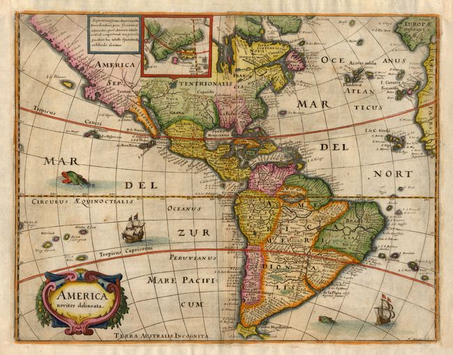
Merian prepared this reduced version of his 1631 map for the German translation of Pierre d'Avity's Les Empires du Monde and it accompanied other works of the period including Theatrum Europaeum. It is one of the many derivatives of Jodocus Hondius' map of 1618. North America is depicted with a prominent Virginia and an odd New England coastline. The western coastline above California makes the continent entirely too wide, and there is an odd, dramatic bulge around Mendocino. There is only a hint of the Great Lakes. There is a large inland lake (Parime Lacus) in equatorial South America. Greenland, Iceland and the mythical island of Frislandia are shown in a small inset map. Strapwork title cartouche, sea monsters and Spanish galleons decorate the map. Merian's signature is located at the lower right.
References: Burden #251.
Condition: B+
Nice impression and lovely old color. Margins have been professionally extended all around and there are hinge remnants on verso.