Subject: Australia
Period: 1826 (dated)
Publication:
Color: Hand Color
Size:
20 x 14.3 inches
50.8 x 36.3 cm
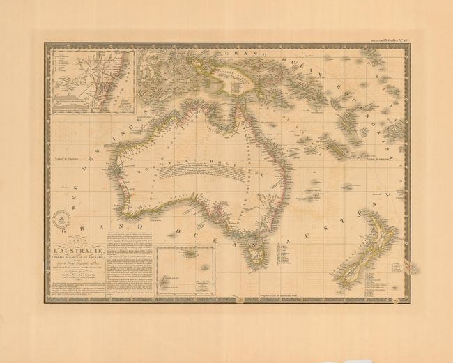
This is a terrific and attractive map of "New Holland" which includes New Zealand and New Guinea, plus many smaller islands. The coastal detail is exceptional with a large number of place names. The interior is virtually blank, but each region is named: Terre de Gran, Baudin, Flinders, Nuyts, Leuwin, d'Edel, Dendracth, Witt, Van Diemen, d'Arnheim, and Carpentarie. An inset of the southeast coast titled "Details d'une partie de la nouvelle Galles Meridionale" illustrates the nine divisions proposed by Captain Vetch of the Royal Corps. With Brue's attractive embossed stamp at left. A decorative keyboard-style border surrounds.
References:
Condition: B
Toned with a little brittleness to paper. Wide margins. Light offsetting over much of the map.