Subject: North Pacific Ocean and Western North America
Period: 1784 (published)
Publication: Voyage to the Pacific Ocean…
Color: Black & White
Size:
26.3 x 15.3 inches
66.8 x 38.9 cm
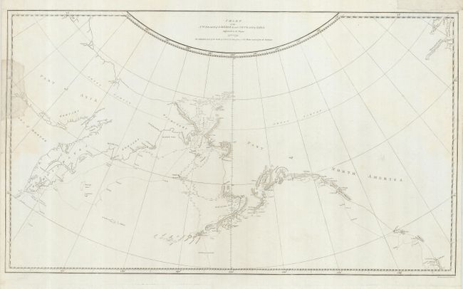
This is the scarce first edition of this map charting Cook's third voyage up the northern reach of the Pacific in his search for a Northwest Passage. Cook probed up along the Oregon coast in bad weather to Nootka Sound, where he rested and refitted his ships. They sailed forth to the Alaskan and Chukotskiy peninsulas and from there into the Bering Strait. Cook got as far as far north as 70 degrees latitude 41’ North before being forced back by the pack ice off Icy Cape. The expedition came south down the Russian coast and then east to Norton Sound. Cook's expedition then sailed south to Hawaii, where Cook was killed in a dispute with the natives. His second-in-command Clerke took over the expedition and they explored further in Hawaii before returning north to continue the exploration for the Northwest Passage. Engraved by T. Harmar.
References: Kershaw #1140; Verner & Stubbs #40, pp. 194.
Condition: B
The map is generally clean, but has some edge tears, with two entering the map on the left and one in the top margin, not affecting the map The tears have been repaired with archival tissue on the recto.