Subject: China, Korea & Japan
Period: 1636 (circa)
Publication:
Color: Hand Color
Size:
19.5 x 16 inches
49.5 x 40.6 cm
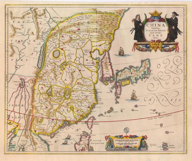
An elegantly engraved map of the region with China (bounded in the northwest by the Great Wall) dominated by several large lakes. The fictitious Chaimay Lacus is shown with numerous rivers flowing south into India and Siam. Korea is depicted as a strangely shaped island separated from the mainland by a narrow strait. Taiwan is located in a roughly correct position, named as both Pakan al I. Formosaand Tayoan The three main islands of Japan are shown on the Ortelius/Teixeira model. The map is richly embellished with European sailing ships and Chinese sampans, a decorative distance scale, and a title cartouche flanked by a Chinese man and woman.
References:
Condition: A+