Subject: Northern Hemisphere
Period: 1745 (circa)
Publication:
Color: Hand Color
Size:
18 x 18 inches
45.7 x 45.7 cm
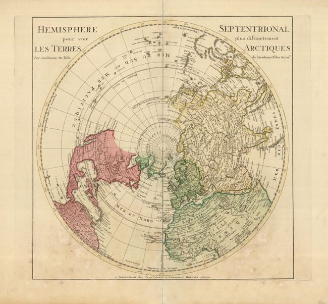
This important map of the Northern Hemisphere was the first map to correctly place the west coast of North America by moving it east substantially from previous mapping. California is correctly shown as a peninsula with the entire northwest coast blank above Cap Mendocino. Near the northern coast of Asia is the Terre de la Compagnie with a note about its discovery by Jean de Gama, and above Japan the Terre d Yeco (Hokkaido) is shown with an uncertain coastline. Delisle based his depiction of the North Pacific on the voyage of Fondant in 1709.
References: Wagner #504.
Condition: B
Nice old color and a dark impression. There are some light stains in the map near the bottom. The centerfold is separated at the top and bottom, just into the map at the top.