Subject: Low Countries
Period: 1579 (dated)
Publication: Theatrum Orbis Terrarum
Color: Hand Color
Size:
19 x 14.5 inches
48.3 x 36.8 cm
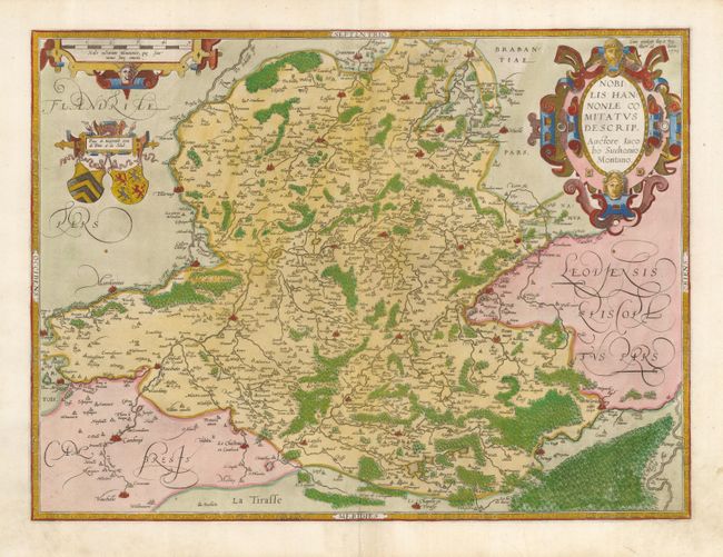
This is a superb copper engraved map of the border region between France and Belgium. It includes the cities of Mons, Maubeuge, and Valenciennes. The history of this map is fascinating. It was based on a manuscript map by Jacques Surhon (1548), which for security reasons was not published. In 1572, Ortelius applied for privilege to publish the map, but his request was never granted. The plate was engraved anyway and several prints made from it appeared in the 1573-1575 editions of Theatrum. That plate was then destroyed and a new one engraved, with privilege, in 1579, while Antwerp was independent for a brief time. This map is from the revised or re-engraved plate. Beautifully embellished with a large strapwork title cartouche, scale of miles and two coats of arms. This issue was published in a Latin edition.
References: Van den Broecke #71.
Condition: A
Nice impression on a sturdy sheet. There are two tiny spots in the map and a light printer's crease at the bottom.