"This Draught of the North Pole is to Shew all the Countries near and adjacent to it, as also the most remarkable Tracks of the Bold Discoverers of them, and Particularly the Attempts of our own Countrymen to find out the N. East and N. West Passages", Moll, Herman
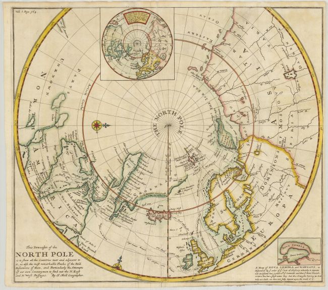
Subject: North Pole
Period: 1705 (circa)
Publication:
Color: Hand Color
Size:
16.5 x 14.75 inches
41.9 x 37.5 cm
Boldly engraved chart of the polar region to 50° N. shows the latest discoveries and routes of numerous explorers during their attempts to find a Northwest and Northeast Passage, including James, Hudson and Barentz. Baffin and Hudson Bays are shown in a rather narrow configuration. Novaya Zemlya is shown correctly on the map as an island, but shown as a peninsula in a small inset with a disclaimer by Moll. The only note on the Pacific coast is that of the Str. of Annian. A second inset shows a north polar projection with the island of California, and notes regarding the destinations of explorers who were searching for a northern passage to Asia.
References: Kershaw #399.
Condition: B
Dark impression and original color. There is a tissue repair of an irregular split on lower fold. Narrow margins as issued.