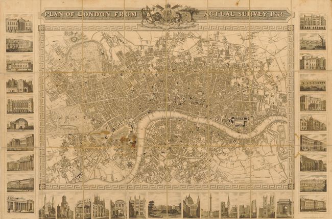
Subject: London, England
Period: 1833 (dated)
Publication:
Color: Black & White
Size:
32.5 x 21.8 inches
82.6 x 55.4 cm
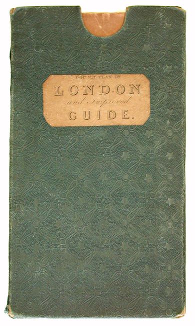
This uncommon plan of London is dissected into 24 sections, backed with linen and folds into its original slipcase, titled "Pocket Plan of London and Improved Guide." The map is highly detailed and extends to Islington, Limehouse, Kennington and Brompton. It shows the New London Bridge and the positions of Lambeth Bridge and Thames Tunnel. The ornamental title is embellished with the royal arms and the arms of the City of London and Westminster. The map is bordered on three sides by 33 beautifully engraved views of famous buildings including Westminster Abbey, Buckingham Palace and the House of Lords. This is the second state of the map that was originally published in 1832.
References: Howgego #343.
Condition: B
Several stains near center and in upper margin. There are some professional repairs on verso of linen reinforcing folds. Slipcase with just a hint of shelf wear.