Subject: Arctic
Period: 1773 (published)
Publication:
Color: Black & White
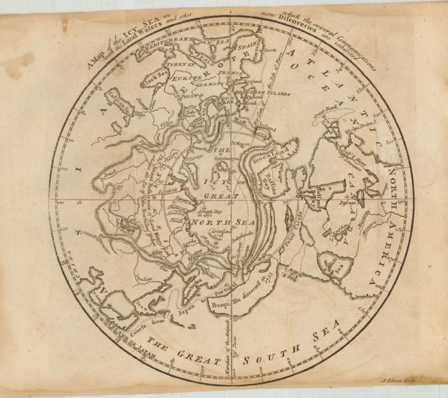
This lot includes two maps published in 1773 with the report of Phipps' voyage towards the North Pole. Phipps commanded the ships Racehorse and Carcase and his crew included the young Lord Nelson as a sailor. The first is a very interesting map of the Northern Hemisphere, based on the work of Jean Palairet with an Icy Great North Sea surrounding the North Pole. Contrary to custom, Europe is located at left with America on the right. The course of the imaginary Northwest Passage is depicted from Portugal to Japan straight across the Pole. The northern part of North America consists of highly distorted landmasses, including an elongated peninsula (or possibly island) where Alaska and the Aleutians are today, which is noted as being discovered in 1753. There is also a massive Sea of the West and a few, speculative Northwest Passages noted, reminiscent of the cartography of Buache. (Cf Jolley GENT-141.) Engraved by John Gibson, 7.8 x 8".
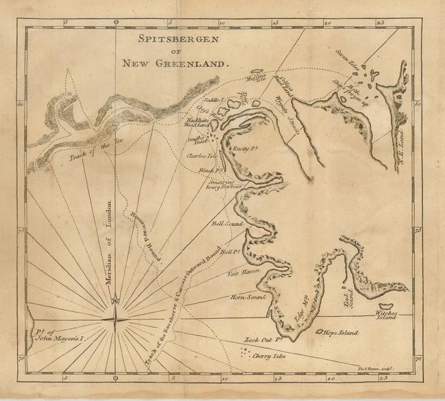
The second outlines a portion of the coastline of Spitsbergen. The compass rose notes the Meridian of London with the map drawn between north latitude 70° to 80°. The tracks of the ships Racehorse and Carcase are shown throughout the region. The "Track of the Ice," and the place were "Both Ship's frozen up" are located.
Spitsbergen is a Norwegian island and is the largest island in the Svalbard archipelago. By Thomas Bowen, 7.8 x 7".
References:
Condition: B
Both are good impressions and printed on thick hand laid paper. Both with a little toning or staining.