Subject: North Pole
Period: 1634 (published)
Publication: Atlas Minor
Color: Hand Color
Size:
8 x 6 inches
20.3 x 15.2 cm
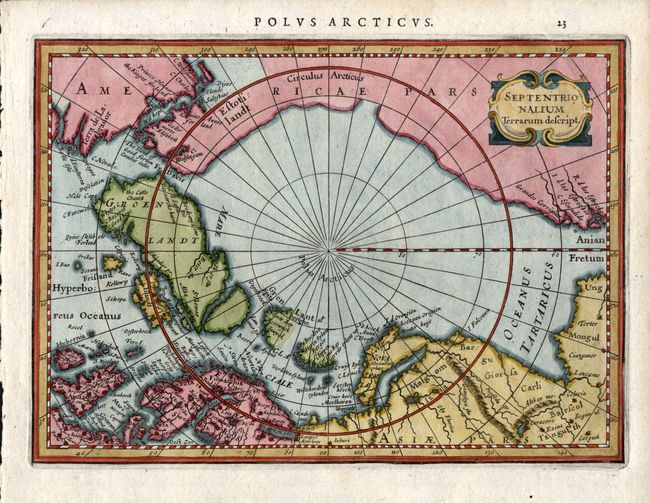
First state of this small map of the North Pole that was first issued in 1628. Jansson's map does not follow Mercator, but used the knowledge of the many recent exploratory voyages that attempted to locate a northern route to Asia. Several fictitious islands, including Frisland, appear in the North Atlantic. It is beautifully colored and decorated with a strapwork title cartouche. Latin text on verso. Abraham Goos and Pieter van den Keere engraved the plates for this atlas. Burden believes Goos executed this plate. A beautiful example of this desirable polar map.
References: Burden #222
Condition: A+
A lovely example with fine coloring and dark impression. Full margins with deckle edge at left.