Subject: Iceland
Period: 1650 (circa)
Publication:
Color: Hand Color
Size:
19.1 x 14.8 inches
48.5 x 37.6 cm
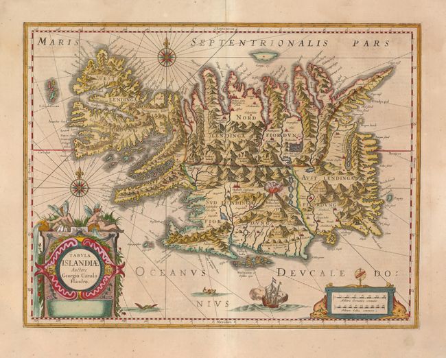
This handsome map of Iceland was based on information from a Dutch navigator named Joris Carolus in about 1620. The map shows the influence of both versions of Bishop Gudbrandur's previous maps, a coastline resembling the Ortelius version, and Mercator's selection and spelling of many place names. The island's topography is dominated by huge mountains, the volcano Hekla, and rugged labyrinth of fiords forming its shoreline. It is richly embellished with title and distance scale cartouches, compass roses, rhumb lines, a sailing ship and two sea monsters. The map was hugely influential for over 130 years as it was printed by two of the largest map publishers in the Netherlands, Willem Blaeu and Jan Jansson. This being the later state without imprint. Spanish text on verso.
References:
Condition: B+
A nice impression with a faint damp stain at top. A few edge tears in blank margins, not affecting the map.