Subject: United States, Texas & Mexico
Period: 1857 (circa)
Publication: Illustrated Atlas and Modern History of the World
Color: Hand Color
Size:
13 x 10 inches
33 x 25.4 cm
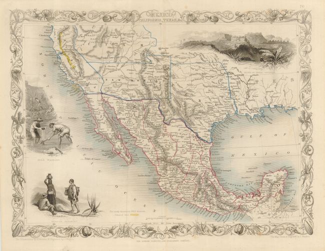
A later edition of this great map depicting the American Southwest and Mexico. After gold was discovered in California, the plate was re-engraved to include a vignette of gold panning and the gold regions of California were delineated through hand coloring. Two other vignettes show Mexican peasantry and the ancient Mayan ruins at Uxmal. The map shows the Gadsden Purchase boundary between the United States and Mexico with the large territories of Utah and New Mexico. Texas is also shown in an unusual configuration, taking in all of present-day Oklahoma. The very decorative border incorporates agaves, squash, prickly pear cactus, and pomegranates all woven together. Map drawn and engraved by John Rapkin, vignettes drawn by H. Warren and engraved by J. Rogers.
References: Wheat (TMW) #694.
Condition: B+
A few light scattered spots of foxing, still a nice example with original outline color.