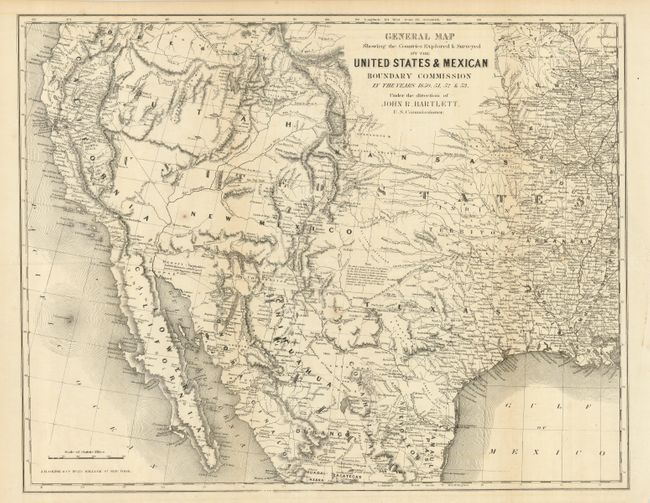
Subject: United States & Mexico
Period: 1855 (published)
Publication: Personal Narrative of Explorations…
Color: Black & White
Size:
19.3 x 15 inches
49 x 38.1 cm
This map covers the entire West from the Mississippi River with particular emphasis on the land recently obtained from Mexico. It is filled with place names, numerous Indian villages, geographical notes and more. Wheat notes this is, all in all, an excellent map of the West that has a very early depiction of the Gadsden Purchase. It is one of the first commercial maps to show Jackson Lake east of the three Tetons, here named Sublettes L. The geography of the unnamed Great Basin follows closely the cartography of Fremont's maps of 1845 and 1848. Utah is in its largest configuration stretching between California and east beyond the Continental Divide to Kansas. Place names include Mormon Sett. in Utah, Franklin is opposite of El Paso and there are numerous New Mexican settlements. The routes of several explorers are identified. The map extends to include all of the Baja. Published by J.H. Colton & Co.
References: Wheat (TMW) #798; Wagner-Camp #234:1
Condition: B
On spot in New Mexico and a binding trim tear that just enters map, closed on verso with archival tape.