Subject: New York City
Period: 1776 (published)
Publication: Universal Magazine
Color: Hand Color
Size:
14.5 x 11.3 inches
36.8 x 28.7 cm
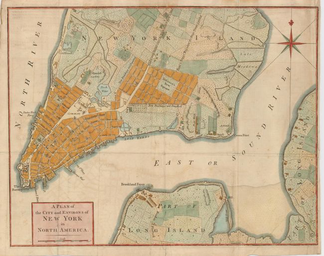
This uncommon plan of New York was issued at the beginning of the Revolutionary War to inform the British public of the growing conflict. The cartography is a compilation of the Montresor (1766) and Ratzen (1767) maps, but with some new additions and details, including the addition of the name Delaney's New Square to an area near the Collect Pond, labeled here Fresh Water, surrounded by blocks of New Buildings not Finished. The square is shown on the Ratzen map as the Great Square, and by the 1780s it is filled with buildings. The map names many streets and roads, including Broadway and the Road to King's Bridge where the Rebels mean to make a Stand, which runs parallel to Road to Kepps Bay where the Kings Troops Landed. It also includes details of the wharves, battery, ferries, orchards, gardens, and houses including the names of some residents.
References: Sellers & Van Ee #1110; Jolly UNIV-177; Nebenzahl (Biblio) #114.
Condition: B
Nice impression printed on sturdy laid paper with an exceptional watermark. Light toning and offsetting, still quite good for a map of this type. Some folds reinforced on the verso.