Subject: World
Period: 1740 (circa)
Publication:
Color: Hand Color
Size:
22.7 x 19.5 inches
57.7 x 49.5 cm
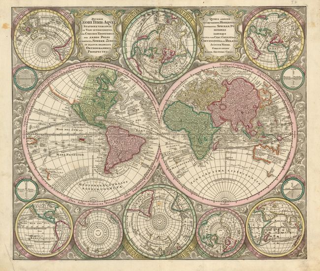
This is one of the most graphic 18th century world maps. The bold engraving style follows Carel Allard's map of 1696 with the central twin hemisphere map surrounded by several smaller maps on various projections. California is an island and is shown five times on the sheet. In Asia, Japan is depicted in a bizarre shape that incorporates Terra Yedso (Hokkaido). The coastlines of Australia and New Zealand are beginning to take shape, and New Guinea is shown twice - once in each hemisphere. The map is filled with detail including the tracks of several explorers. The maps are set in a richly engraved background of clouds with numerous wind heads, lesser spheres and two cartouches.
References: Portinaro & Knirsch CXIX
Condition: B+
There are a few tiny stains, but the sharp impression and original color more than make up for them.