Catalog Archive
Auction 120, Lot 221

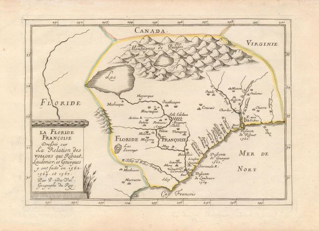
"La Floride Francoise Dressee sur la Relation des Voiages que Ribaut Laudonier, et Gourgues y ont faits en 1562, 1564, et 1567", Duval, Pierre

Subject: Colonial Southeast

Period: 1677 (published)

Publication: Diverses Cartes et Tables pour la Geographie..

Color: Hand Color

Size:
9 x 6.5 inches
22.9 x 16.5 cm
Download High Resolution Image
(or just click on image to launch the Zoom viewer)

This scarce map depicts the French colonization attempts in the Southeast, showing the landings of Ribaut, Laudonier and Gourgues. Canada and Virginia are shown beyond the borders of La Floride. The map depicts the region first illustrated by Cornelis Claesz in 1602, centered on the May River and Port Royal. The landing points of the French expeditions are shown along the coastline. Several Indian villages are noted in the interior, which is dominated by the Montagnes de Palassi and a huge lake from which the May R. (St. John's River) flows in a south-easterly direction. This is the second state of the plate with the hyphen in Du-Val.

References: Burden #381; Cumming (SE) #61.

Condition: A+

Estimate: $1,200 - $1,500

Sold for: $2,300

Closed on 7/18/2007

Archived